Undoubtedly, most of us have encountered an error on Google Maps at least once. Whether it directed us along an unfamiliar route, plunged us into heavier traffic, or continuously suggested a completely different destination than we intended, these glitches are part and parcel of using technology. Nevertheless, it is one thing when a Google Maps mistake results in incorrect directions, and quite another when it has implications for international border discussions. Yes, Google Maps plays such a critical role in maintaining global stability that a single error can incite international disagreements. Interested in learning more? Prepare to discover the 25 Biggest Google Maps Mistakes.

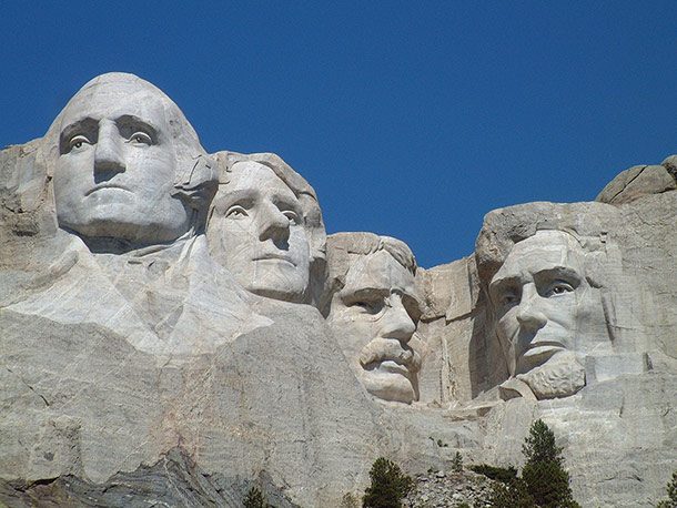
Mount Rushmore
 Source: http://www.courant.com/consumer/hc-ls-tech-google-maps-errors-0410-20160411-story.html
 For nearly five years, Google Maps was sending people to the wrong location when they typed “Mount Rushmore, SD.” Instead, it took people to a retreat center called “Storm Mountain Center,” which was about thirteen miles away from the real Mount Rushmore. The problem became so persistent, they had to put up a street sign warning people about it.
Round Valley State Park
 Source: https://abcnews.go.com/Technology/google-maps-mistakes-jersey-house-state-park/story?id=14056722
 When people entered “Round Valley State Park” into Google Maps, they instead ended up at New Jersey resident Laurie Gneiding’s house. People trickled in at first, asking for the state park, and Gneiding would kindly tell them they were on private property and where the park was actually located. Eventually, dozens would come by every year at all hours, sometimes acting indignant and belligerent.
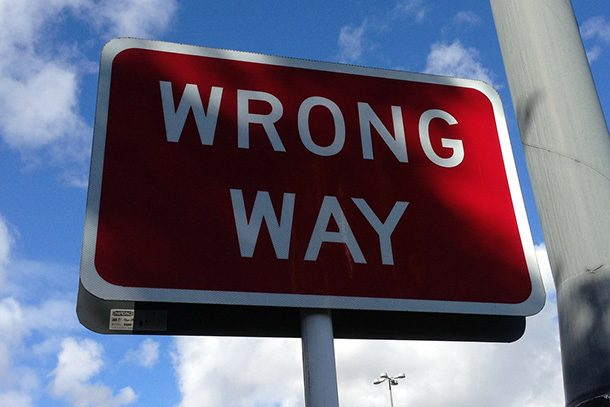
Wrong Direction
 Source: http://www.courant.com/consumer/hc-ls-tech-google-maps-errors-0410-20160411-story.html
 This is more human error than Google’s error, but at one point, Noel Santillan, an American tourist in Iceland, drove six hours in the wrong direction simply because he spelled part of the address wrong.
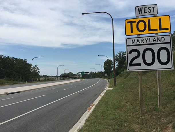
The Intercounty Connector
 Source: http://www.baltimoresun.com/bs-mtblog-2011-03-on_google_the_icc_is_open_all_1-story.html
 In 2011, while they were doing construction in Maryland on the Intercounty Connector, an electric toll road, Google Maps indicated the entire 41.9-mile stretch was open. In fact, only 6-miles of it had been completed and the rest was still a construction site.
Emden, Germany
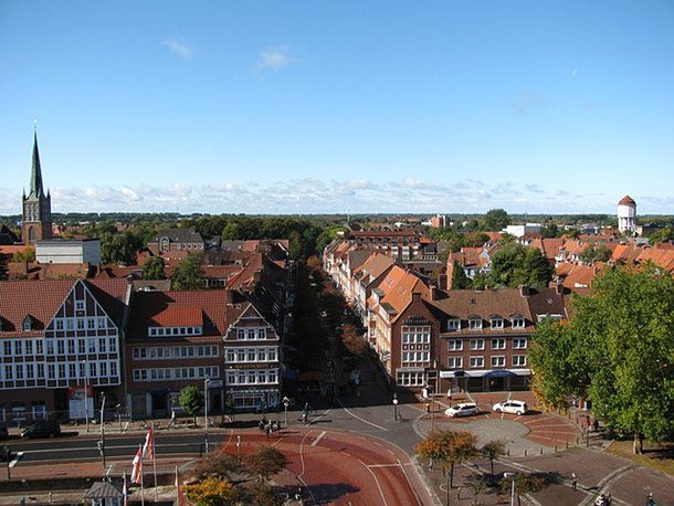 Source: https://www.bbc.com/news/world-europe-12558741
 Located in North-West Germany, Emden sits right next to the Netherlands border, and Google made the error of including part of Emden’s harbor in Netherland’s territory. According to a Google spokesman, however, a border dispute dating back to the 15th century was to blame.
Grand Canyon
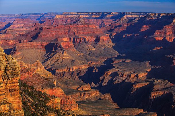 Source: https://www.news.com.au/technology/online/relying-on-google-maps-got-this-woman-stranded-in-the-grand-canyon-for-five-days/news-story/5c0e6b404f6d24ecab7bd857ca12c722
 While visiting the Grand Canyon, 24-year-old Amber Vanhecke used Google Maps to guide her way, but unfortunately, it took her down a wrong road, leaving her stranded when her car ran out of gas. With her phone not working and her food and water diminishing, she thought she was going to die and recorded farewell videos. Luckily, after 119 hours, she was rescued.
Saint Pierre and Miquelon
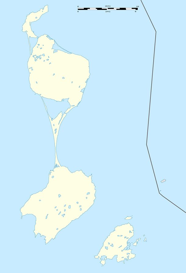 Source: https://www.cio.com/article/2405903/internet/6-memorable-google-maps-mishaps.html#slide7
 In 2010, someone reported that Google Maps incorrectly had the French islands of Saint Pierre and Miquelon underwater. Though the land formations were gone, the roads remained intact.
Boston South Station
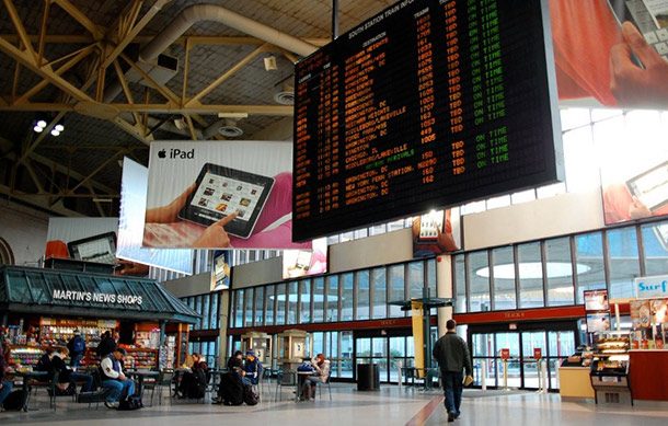 Source: https://www.reddit.com/r/GoogleMaps/comments/381ar2/thousands_have_likely_been_misled_by_this_boston/
 A Redditor discovered the Google Map directions to Boston’s popular and traffic heavy South Station were placing the building underground adjacent to I-93. Even though the building extends below ground, there’s no entrance underground. He found this out when his driver kept dropping him off at the wrong spot.
Christ the Redeemer
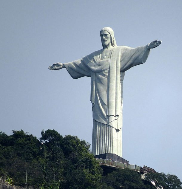 Source: http://www.foxnews.com/world/2017/02/28/tourists-using-google-maps-to-get-to-rio-landmark-enter-favela-get-shot.html
 Argentinian tourist Natalia Lorena Cappetti, her husband, and another couple used Google Maps to get to the famous Christ the Redeemer statue in Rio de Janeiro. Instead, Google Maps took them to Morro dos Prazeres, one of their most dangerous slums. When they traveled through there, they endured heavy gunfire and Natalia Cappetti was shot in the back. At the time of reporting, she was in serious condition and undergoing surgery.
Rowlett, Texas
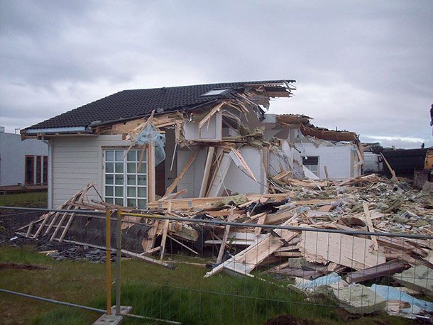 Source: https://www.independent.co.uk/news/world/americas/lindsay-diaz-google-maps-demolition-house-home-accident-a6952356.html
 In 2016, Lindsay Diaz pulled up to her driveway to find quite a surprise – her entire house was demolished. The firm Billy L Nabors Demolition tore down her house by mistake, claiming they used an incorrect listing on Google Maps.
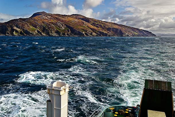
Underwater Tunnel
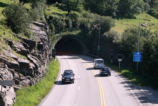 Source: https://www.travelandleisure.com/travel-tips/ground-transportation/cyclist-shuts-down-underwater-tunnel
 After using Google Maps for directions, a Turkish cyclist shut down a 4.5-mile underwater tunnel in Norway for thirty minutes as it wasn’t made for cyclists. Authorities had to go on a rescue mission to find the man and remove him from the area.
Sunrise, FL
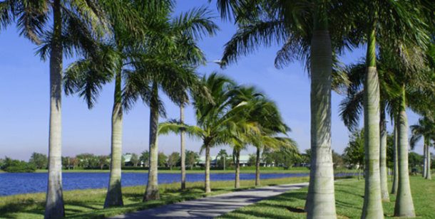 Source: http://www.cnn.com/2010/TECH/web/09/22/google.lost.sunrise.florida/index.html
 In 2010, Google Maps virtually erased an entire city from the map. It’s called Sunrise, Florida, and at the time, if you tried to enter it in Google Maps, you’d be taken to Sarasota, Florida, instead. Funny enough, it’s not a small city either, boasting 90,000 people, a large mall, a National Hockey League team, and one of the first IKEA’s in the state.
Business Shut Down
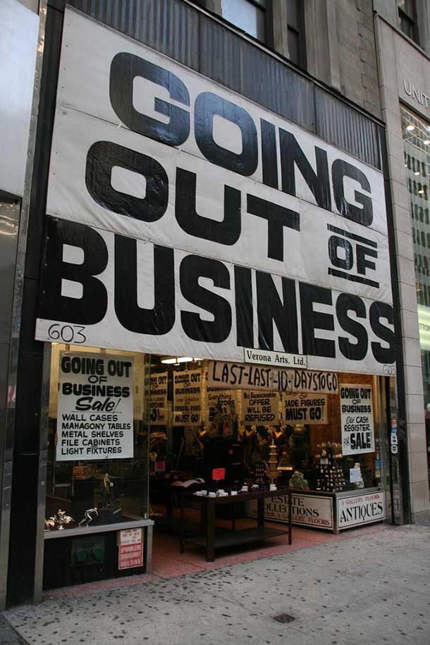 Source: http://smahtideas.com/google-maps-can-hurt-your-business/
 Google Maps can have a devastating effect on businesses. In 2010, several Buffalo, NY jewelry stores noticed a detrimental slowing of their sales. Someone told Google Maps their businesses were shut down, limiting their exposure to only foot traffic. They found out later the culprit was a rival jewelry store owner.
Borgarfjörður
 Source: http://icelandmag.is/article/error-google-maps-send-foreign-travellers-holiday-home-neighborhood
 The Icelandic holiday village of Borgarfjörður also noticed increased tourist traffic when Google Maps incorrectly brought tourists there instead of Svignaskarð farm and cottages, roughly 5 miles north of Borgarfjörður.
Walking Directions
 Source: https://www.telegraph.co.uk/technology/google/7795460/Lauren-Rosenberg-US-woman-sues-Google-after-Maps-directions-caused-accident.html
 Los Angeles resident Lauren Rosenberg decided to go for a stroll one day and used Google Maps to find the safest route to guide her 2-mile path. It eventually took her down to a four-lane highway without sidewalks, a place clearly unsafe for pedestrians. She continued to follow the path and walked out on the highway with high-speed traffic. As a result, Rosenberg ended up hospitalized and sued Google for damages, but the court ruled against her.
Costa Rica-Nicaragua Border
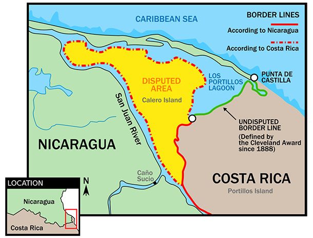 Source: http://www.cnn.com/2010/TECH/web/11/05/nicaragua.raid.google.maps/index.html
 In 2010, when Google Maps drew the Costa Rica-Nicaragua border, Nicaraguan troops crossed over, removed the Costa Rica flag and placed down their own. The dispute became so heated, the U.N. Security Council and Organization of American States had to intervene. They determined Google Maps was, indeed, wrong.
Preikestolen Cliff
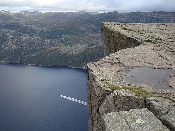 Source: https://www.travelandleisure.com/travel-tips/mobile-apps/norwegian-town-preikestolen-google-maps
 For a time, tourists in Norway looking for Preikestolen cliff were in for a rude awakening if they used Google Maps. Instead, the app would send them to Fossmork, a small Norwegian village about 20-miles away. The town would become overwhelmed with dozens of minibusses full of tourists, looking for the cliff.
Jakarta, Indonesia
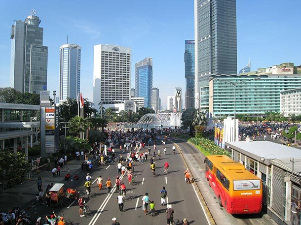 Source: http://www.scmp.com/week-asia/society/article/2139712/you-have-not-arrived-why-google-maps-lost-cause-indonesian-drivers
 According to residents of Jakarta, using Google Maps only makes your travel worse. In one case, a food delivery driver used the app only to end up in a totally different spot than she needed and had to ask around for directions. Many ride-hailing drivers also refuse to use the app, feeling it won’t have the shortcuts needed to get to a location quickly.
Scottish Island
 Source: http://www.bbc.com/news/uk-scotland-glasgow-west-23331456
 Along with a city and islands in Canada, Google Maps also had the power to make the Scottish island of Jura disappear. In 2013, users noticed the disappearance the island and contacted Google about it. They admitted to the error and said, “…our engineers are beavering away to fix it.”
Wal-Mart Closed
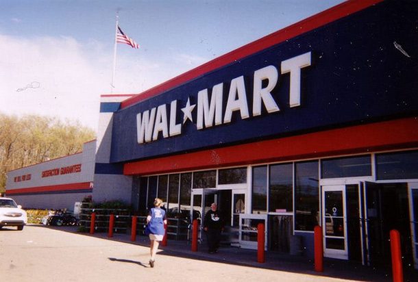 Source: http://www.koco.com/article/google-business-listing-shows-all-walmart-stores-permanently-closed/4309070
 A report by 5 KOCO News claimed in 2016 that if you searched on Google Maps for a Wal-Mart, it listed the megastore as permanently closed. At the time of reporting, it was unclear who was responsible or when the problem would be fixed. One thing is for sure, Wal-Mart is definitely not closed.
Farm Glitch
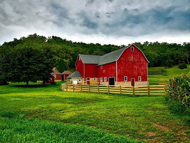 Source: https://splinternews.com/how-an-internet-mapping-glitch-turned-a-random-kansas-f-1793856052
 After an IP mapping error by a company called MaxMind, a simple family living on a farm underwent harassment from all kinds of people for years. Google Maps used this address so that when anyone searched for it, tons of nefarious activities would come up in the search, but the farm had nothing to do with any of it. For ten years, they’ve been accused of being frauds, kidnapping children, and were even investigated by the FBI, IRS, and other police organizations. Eventually, MaxMind updated their database to the correct information.
Serbian Crown
 Source: https://www.wired.com/2014/07/hacking-google-maps/
 In another case of business tampering, the Serbian Crown, a delicacy restaurant open for 40 years, was forced to shut its doors when it lost 75 percent of its clientele overnight. The problem persisted, and the owner had to lay off his staff and eventually close up shop. He found out later that Google Maps had incorrectly stated the store wasn’t open Saturday, Sunday, and Monday, three of his prime business days. The owner’s lawyers suspect another business sabotaged them by posting the false hours.
Indecent Exposure
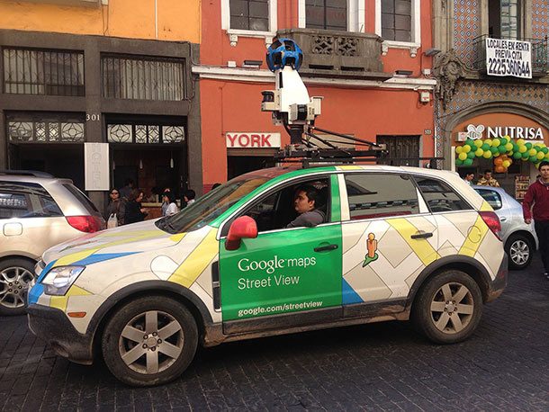 Source: http://www.cbc.ca/news/canada/montreal/google-street-view-of-quebec-woman-s-breast-leads-to-damages-award-1.2815841
 While a Montreal woman sat on her front step scrolling through her smartphone, a Google Street View car drove by, taking pictures. Years later, she remembered the encounter and went to go see the results. They blurred her face, but not her home address, her car license plate, nor her partially exposed breast. She filed a lawsuit against Google, claiming a violation of privacy and ended up winning.
Fake Numbers
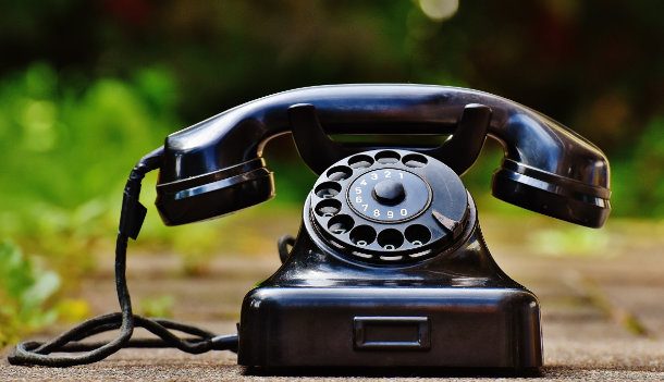 Source: http://valleywag.gawker.com/how-a-hacker-intercepted-fbi-and-secret-service-calls-w-1531334747
 Network engineer Bryan Seely discovered a flaw in Google’s lax approach to their Google Maps system. He set up two fake listings for both the FBI and the US Secret Service, providing fake phone numbers. When unwitting citizens would call those numbers, they would dial into his number which would then reroute them to a real FBI location. However, they were using his line, and he would record the calls. Seely was eventually caught by the Secret Service but was let go soon after when they discovered he did it to prove a point after Google ignored his pleas to fix the problem.
Racial Slur
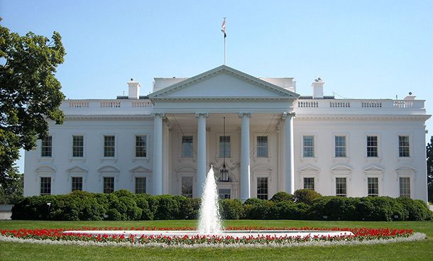 Source: https://www.washingtonpost.com/news/the-switch/wp/2015/05/19/if-you-search-google-maps-for-the-n-word-it-gives-you-the-white-house/?noredirect=on&utm_term=.3549c52f25dd
 In 2015, it was discovered that if you typed in “N***** king” into Google Maps, it would take you to the White House. Other offensive racial epithets were attributed to the White House as well. This was due to Google allowing people to have the ability to edit features on its maps. When Google became aware of this, it suspended the accounts of those responsible.

 4")

 6")


 10")


.jpg)
.jpg)
_just_west_of_U.S._Route_1_(Baltimore_Avenue)_in_Konterra,_Prince_Georges_County,_Maryland.jpg)